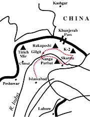
Detailed
Itinerary 

|
| |
Islamabad | | | Skardu |
| | Askolie |
| | Mongo |
| | Biantha |
| | Naqpogoro |
| | Karfogoro |
| | Marphogoro |
| | Snow
lake | | | Hispar
La | | | Kani
Basa | | | rest
day | | | Jutmal |
| | Pumory |
| | Bitanmal |
| | Falaling
Chhish | | | Hispar
Village | | | Karimabad |
| | Gilgit |
| | Islamabad |
| | | | 
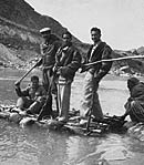
MASOOD'S
FATHER CROSSING RIVER ON A 'ZHAK'--1952 |
Biafo
Glacier (60 km. long) and Hispar Glacier (61 km. long) meet at the 5151 m. Hispar
Pass to form one of the longest glacial systems outside the polar regions. This
highway of ice connects two ancient mountain kingdoms; Hunza in the west with
Baltistan in the east. In olden times warriors from Hunza would use
this natural pathway to invade the peoples of Askolie in Baltistan. Later, the
well known sport of "Polo," a Balti word meaning ball, served as a more
positive outlet for aggression between these two kingdoms and matches were played
on stretches of level ground in this locality. Because the Biafo-Hispar
region is very remote it serves as the last stronghold for many animals; including
Himalayan bear, ibex, markhor and the snow leopard. H.W. Tilman, an English adventurer,
claimed he saw footprints of the Yeti during his trek there in 1937. At
the base of Hispar Pass on its eastern flank rests Snow Lake, a basin of ice (16
km. wide) surrounded by granite pinnacles yet to be climbed. Glaciologists have
conducted various experiments on the lake and have found the ice to be approximately
1.6 km. deep. Some go as far as to say that Snow Lake represents the last of the
original ice cap in the earth's temperate zones. The first segment of the
journey from Islamabad to Askolie is identical to that of the K-2 Trek (see enclosed).
We begin our walk from Askolie towards K-2 then shortly head west onto the Biafo
Glacier. After trekking three to four days we arrive at Baintha Campsite located
on an ablation valley below the granite peaks of the Ogre (7813 m.). The
walk takes us past glistening clear lakes, bright spots of green grass, glorious
wild flowers and the ever present vertical snow covered peaks hanging above to
complete this dazzling scene. The next two days take us over the white covered
Biafo Glacier to Snow Lake. We then make the exhilarating walk up to Hispar Pass
continuously overwhelmed by the incredible views. Having reached the highest
point of our journey atop Hispar Pass (5151 m.) we begin the descent into Hunza;
a land where the language, culture and ethnic background is vastly different than
that of Baltistan. We follow the Hispar Glacier past massive mountains such as
Kanjut Sar (7760 m.) and Disteghil Sar (7885 m.) reaching the end of the glacier
in four to five days. The green oasis of Hispar Village awaits us signaling
only another dayÍs walk before a jeep transports us to Karimabad, Hunza. First
sight of the lush valley of Hunza is breathtaking and in some ways makes up for
the nostalgia one feels after completing a long walk. We spend one night in Karimabad
then we are off to Gilgit by way of the KKH. Depending on weather conditions we
then fly or drive back to Islamabad.
Day
1, Rawalpindi/Islamabad: Hotel, trek briefing. We will have ample time for
sightseeing and shopping in colorful old bazaars of Rawalpindi and new markets
of Islamabad. We may also drive to the huge modern Faisal Mosque in Islamabad. Day
2, Skardu (2,500 m 8,200 ft): Hotel, flight. We will be on the most fantastic
commercial flight in the world taking us from Islamabad to Skardu. If the weather
is bad, we will drive in two days on the famous KKH to Skardu. Day
3, Askolie (3,300 m 10,800 ft): Camp, jeep drive. It takes about six hours
to drive from Skardu to Askolie or near Askolie. The drive through the Braldu
Gorge is guaranteed to knock your socks off! Day
4, Namla (3,650 m 11,800): Camp, trek begins. The walk from Askolie to Namla
is on an easy gentle plain first and then becomes difficult as we get on to the
snout of Biafo Glacier. This will take about 6 to 8 hours. The first sight of
the pinnacles of the Paiyu Group is stunning. Day
5, Mongo (3,700 m 12,130 ft): Camp, trek. This can take 7 hours or more. We
walk on the moraines of Biafo Glacier as well as in an ablation valley. This is
not an easy walk as we trek on rocks most of the time. Day
6, Biantha (4,000 m 13,120 ft): Camp, trek. From Mongo we get on to the white
Biafo Glacier where the walking is easier and then we diagonally walk across the
Biafo to reach its other side near Biantha. The difficult parts here are getting
on to the glacier and then getting off it. This takes about 6 hours of walking
and will give us our first sight of the Latok Group. The campsite is located in
a green meadow. Day 7, Biantha (4,000
m 13,120): Camp, rest day. Wash up, relax, read, climb on a steep ridge for outstanding
views behind the camp, sing and dance with the porters! Day
8, Marphogoro (4,400 m 14,430 ft): Camp, trek. Six to eight hours of walking.
Getting on to the glacier is tricky. Once on it, the walk is pretty straight forward
on the white glacier. However, we are careful to avoid crevasses here. The greenery
of Biantha campsite is only a memory now. We are in the dramatic and awesome expanse
of the Biafo with its jagged pinnacles. The Ogre (7,813 m.) towers high above
us on our right. There is only snow and rock now. Day
9, Snow Lake (4,800 m 15,750 ft): Camp, trek. The trek takes about 6 to 7
hours over ice and snow. Once again we are careful to avoid crevasses along the
way. Snow Lake is a magical place. Be sure to get out of the tent to experience
the stars in the night. It is an unforgettable experience! Day
10, Snow Lake (4,800 m 15,750 ft): Camp, rest day. We stay at Snow Lake one
more day to acclimatize and explore this unique area of the Earth. Be careful
of crevasses. Day 11, Hispar La (5,151
m 16,895 ft): Camp, trek. A 6 to 7 hour walk on slopes of about 30 degrees take
us to the top of the pass. Once again, we are careful to avoid crevasses. Even
though the climb is on gentle slopes, we find it difficult due to the rarefied
air. When on top we see a panorama described by an early explorer: “Beyond all
comparison the finest view of mountains it has been my lot to behold.” On one
side the Biafo lies and on the other side we look towards the Hispar Glacier and
the peaks above Hunza valley. The view of sunrise from the pass is another sight
to behold. Day 12, Kani Basa (4,500 m
14,760 ft): Camp, trek. This is a long day’s walk and can take more than 8 hours.
We want to make sure that we leave the pass early before the snow becomes soft.
On the way down, once again, we are careful to avoid crevasses. We will have to
cross the Kani Basa Glacier before we can camp on a green campsite, which is a
welcome sight and site after being on snow for the last few days. On the way we
can see the famous Kanjut Sar (7,760 m.) towering high above the Kani Basa Glacier.
Day 13, Kani Basa (4,500 m 14,760 ft):
Camp, rest. A well needed day to relax after a tough walk through Hispar La and
snow. Day 14, Jutmal (4,200 m 13,780
ft): Camp, trek. This will take about 7 hours and on the way we will cross the
Jutmal Glacier. It is tricky here as the route through the glacier is like a maze
with high ice walls. After crossing it, another hurdle that we face is the climb
up on a loose cliff face. Once up the face, we now enter a beautiful campsite
with lovely views across the Hispar Glacier. Some streams have to be crossed on
the way. Day 15, Bitanmal (3,600 m 11,800
ft): Camp, trek. This section takes about 8 hours. On the way Pumory Glacier is
crossed and also a stream. The crossing of Pumory is not that difficult as the
Jutmal. However, once again, we have to descend on to the ablation valley and
once again we have to climb the cliffs on our right to get to the campsite. This
is an exhaustive process. Day 16, Falaling
Chhish (3,600 m 11,800 ft): Camp, trek. One more glacier to cross! This is Kunyang
Glacier. The walking does get a little easier. However, crossing the Kunyang is
tedious and the climb on rocks on the other side can be difficult. This is a short
day consisting of about 4 hours. Our camp is in a shepherd’s meadow where villagers
from Hispar bring their yaks for the summer. The view of Makrong Chhiish (6,607
m.), on the other side of Hispar Glacier, is outstanding. Day
17, Hispar Village (3,400 m 11,150 ft): Camp, trek. Another short day of about
4 hours. Some streams have to be crossed on the way, but the walking is relatively
gentle. A bridge over the Hispar stream has to be crossed and then a climb on
a good path brings us into the village proper. It is strange to see habitation
as the villagers gather around us! Day
18, Huru (3,000 m 9,840 ft.): Camp, trek. This takes about 5 hours of walking
on a jeep road. The road is marked with a few broken bridges and land slides that
have resulted in jeeps not coming all the way to the Hispar Village. Our campsite
is high above the noisy Hispar River in a tree-shaded spot. There is also a cool
pool nearby. Here our epic trek ends. Day
19, Karimabad (2,440 m 8,000 ft): Hotel, jeep. Our jeeps will transport us
back to Karimabad, Hunza. The first sight of this lush green valley surrounded
with huge white peaks will remain an imprint on our minds for a long time. Day
20, Gilgit (1,500 m 4,900 ft): Hotel, drive. We drive to Gilgit in about three
hours and have ample opportunity to visit the Central Asian bazaars and do some
sightseeing. Day 21, Rawalpindi/Islamabad:
Hotel, flight and trek debriefing. Here we go again and find ourselves looking
forward to being on this world famous flight. One can never get enough of the
sight of Nanga Parbat, which is so huge that the plane takes about ten minutes
to cross its northern face! Note: On
day 21 if the flight does not operate due to the weather, we will then return
to Rawalpindi/Islamabad by road on the KKH. This will be a long day and we will
arrive back in Rawalpindi/Islamabad sometimes during late evening or night of
the same day. On the other hand the flight takes under 2 hours. We have three
rest days in the above itinerary. We believe that they are necessary, keeping
in view of the nature of the trek. These days will also be utilized to help us
get back on schedule in case of bad weather and other route and health problems
not in our control. This is a tentative itinerary. For the
enjoyment of your trip a ‘go with the flow’ attitude is necessary. Many factors
will influence your trip, such as weather conditions, health, route conditions,
etc. Please do not take this itinerary very seriously! | 
![]()

![]()